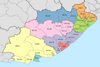
Mhlontlo Local Municipality
Mhlontlo | |
|---|---|
 Location in the Eastern Cape | |
| Country | South Africa |
| Province | Eastern Cape |
| District | OR Tambo |
| Seat | Qumbu |
| Wards | 26 |
| Government | |
| • Type | Municipal council |
| • Mayor | Cllr Mbulelo Jara (ANC) |
| • Speaker | Cllr Eddie Pula (ANC) |
| • Chief Whip | Cllr Ntombikayise Gcaba (ANC) |
| Area | |
• Total | 2,826 km2 (1,091 sq mi) |
| Population (2022)[2] | |
• Total | 186,391 |
| • Density | 66/km2 (170/sq mi) |
| Racial makeup (2011) | |
| • Black African | 97.6% |
| • Coloured | 0.3% |
| • Indian/Asian | 0.2% |
| • White | 0.1% |
| First languages (2011) | |
| • Xhosa | 94.9% |
| • English | 2.3% |
| • Other | 2.8% |
| Time zone | UTC+2 (SAST) |
| Municipal code | EC156 |
Mhlontlo Municipality (Xhosa: uMasipala wase Mhlontlo) is a local municipality within the OR Tambo District Municipality, in the Eastern Cape province of South Africa.
The Mhlontlo Municipality is a municipality situated along the N2 national route between Mthatha and KwaBhaca. It encompasses the towns of Qumbu and Tsolo, together with the surrounding villages. There are three hospitals within the municipality; the Nessie Knight Hospital in Sulenkama village (Qumbu), the St Lucy Hospital in Ngcolosi village (Tsolo) and the Dr Malizo Mpehle Hospital near the town of Tsolo. The municipality is the seat of the AmaMpondomise Kingdom, which seats at Lower Kroza village near Qumbu.
Mhlontlo was a king of the AmaMpondomise people during the 19th century.[3]
Main places
[edit]The 2001 census divided the municipality into the following main places:[4]
| Place | Code | Area (km2) | Population |
|---|---|---|---|
| Amacwera | 23501 | 177.82 | 20,419 |
| Amampondomise | 23502 | 109.24 | 12,566 |
| Amazizi | 23503 | 0.35 | 0 |
| Asentshonalanga | 23504 | 8.02 | 475 |
| Basuto | 23505 | 7.95 | 0 |
| Bhele | 23506 | 70.31 | 4,240 |
| Bovube | 23507 | 197.19 | 18,717 |
| Culunca | 23508 | 99.50 | 9,501 |
| Ebotwa | 23509 | 203.35 | 22,254 |
| Emaqa-Kambani | 23510 | 162.71 | 10,214 |
| Hala | 23511 | 67.98 | 2,907 |
| Hlubi | 23512 | 280.77 | 22,631 |
| Kambi | 23513 | 6.87 | 369 |
| Ketani | 23514 | 70.06 | 7,600 |
| Lwandlolubomvu | 23515 | 48.43 | 1,625 |
| Makaula | 23516 | 24.83 | 629 |
| Masizakhe | 23517 | 293.67 | 18,661 |
| Matolandile/Zimelelandile | 23518 | 32.91 | 52 |
| Mbalisweni | 23519 | 125.22 | 10,021 |
| Mhlontlo | 23520 | 19.82 | 6 |
| Ngqubusini | 23521 | 106.95 | 5,855 |
| Ngwane | 23522 | 16.95 | 633 |
| Northern Pondomise | 23523 | 294.50 | 15,987 |
| Qumbu | 23524 | 38.15 | 3,275 |
| Tsolo Part 1 | 23525 | 53.97 | 5,678 |
| Tsolo Part 2 | 23526 | 184.59 | 2,361 |
Politics
[edit]The municipal council consists of fifty-one members elected by mixed-member proportional representation. Twenty-six councillors are elected by first-past-the-post voting in twenty-six wards, while the remaining twenty-five are chosen from party lists so that the total number of party representatives is proportional to the number of votes received. In the election of 1 November 2021 the African National Congress (ANC) won a majority of forty seats on the council. The following table shows the results of the election. [5]
| Party | Ward | List | Total seats | |||||
|---|---|---|---|---|---|---|---|---|
| Votes | % | Seats | Votes | % | Seats | |||
| African National Congress | 29,816 | 71.69 | 25 | 32,001 | 77.74 | 15 | 40 | |
| United Democratic Movement | 2,218 | 5.33 | 0 | 2,749 | 6.68 | 3 | 3 | |
| Economic Freedom Fighters | 2,294 | 5.52 | 0 | 2,491 | 6.05 | 3 | 3 | |
| Independent candidates | 4,436 | 10.67 | 1 | 1 | ||||
| African Transformation Movement | 1,757 | 4.22 | 0 | 1,810 | 4.40 | 2 | 2 | |
| Independent South African National Civic Organisation | 333 | 0.80 | 0 | 1,253 | 3.04 | 1 | 1 | |
| Democratic Alliance | 612 | 1.47 | 0 | 609 | 1.48 | 1 | 1 | |
| Batho Pele Movement | 120 | 0.29 | 0 | 98 | 0.24 | 0 | 0 | |
| Civic Independent | 2 | 0.00 | 0 | 153 | 0.37 | 0 | 0 | |
| Total | 41,588 | 100.00 | 26 | 41,164 | 100.00 | 25 | 51 | |
| Valid votes | 41,588 | 97.02 | 41,164 | 97.06 | ||||
| Invalid/blank votes | 1,276 | 2.98 | 1,246 | 2.94 | ||||
| Total votes | 42,864 | 100.00 | 42,410 | 100.00 | ||||
| Registered voters/turnout | 93,164 | 46.01 | 93,164 | 45.52 | ||||
References
[edit]- ^ "Contact list: Executive Mayors". Government Communication & Information System. Archived from the original on 14 July 2010. Retrieved 22 February 2012.
- ^ a b c "Statistics by place". Statistics South Africa. Retrieved 27 September 2015.
- ^ South African Languages - Place names
- ^ Lookup Tables - Statistics South Africa[permanent dead link]
- ^ "Election Result Table for LGE2021 — Mhlontlo". wikitable.frith.dev. Retrieved 24 February 2022.


